Researchers develop bioinspired geolocation method based on daytime sky polarization

The first guy on Earth who ever got lost probably said to himself, “I could really use a set of geographic coordinates expressed as latitude and longitude right about now.” Time passed, neocortexes evolved, and eventually, compasses and sextants gave way to global navigation satellite systems for geoposition and navigation.
However, these systems are often unreliable and susceptible to jamming and spoofing. Magnetic compasses, while still useful, are subject to magnetic interference, and celestial navigation is only possible on a clear night without the interference of light pollution.
A French research team developing an alternative geoposition method sought examples of geolocation methods from biology. While many species of birds and insects calibrate their magnetic compasses via the movements of stars around the Earth’s magnetic pole, they noted that some migrating bird species calibrate their internal compass during the day based on skylight polarization patterns. The theory suggests that sunlight is scattered by small particles present in the Earth’s atmosphere, and over the years, researchers have developed GPS-free navigational techniques exploiting this model.
The researchers cited the specific example of the Cataglyphis desert ant. These ants forage in daylight for dead insects, hunting in a zigzag pattern. Each time an ant changes direction, it raises its head and takes a reading on the sun. When it finds a food source, it returns directly to the nest in a straight line to minimize its direct exposure to sunlight in the high heat of the desert, essentially computing its course via biological skylight polarization analysis.
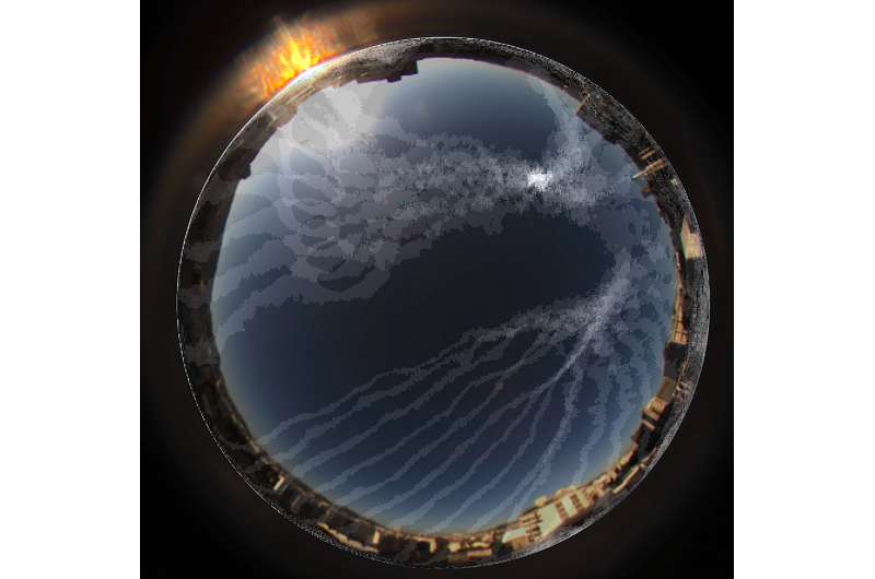
The research team now reports a system called Skypole that uses a polarimetric camera to measure the degree of skylight polarization rotating with the sun. By processing captured images of the sky, the team was able to determine the position of the north celestial pole and pinpoint the observer’s latitude and bearing. Their study is published in the Proceedings of the National Academy of Sciences.
It is generally accepted that animals use skylight polarization to determine geolocation, but it is unclear how they use that information. The team took a cue from a theory that animal species like Cataglyphis use temporal properties of the skylight polarization pattern to position themselves, and developed a system that compares polarimetric images of the sky in order to find true north.
The team compared images taken at two distinct moments with time intervals ranging from 30 to 60 minutes and computed the differences in two features: the degree of linear polarization and the angle of linear polarization. Their algorithm accounts for the constancy of the degree of linear polarization at the celestial north pole, as well as the two variables captured in the images.
The method they describe has a number of advantages: Using only visual information, the system derives geolocation with reasonable accuracy, without reliance on time, date or initial position. Their image processing package is minimal and operates with modest computing resources. However, the image acquisition intervals and the system’s degree of accuracy currently preclude certain geolocation applications.
The researchers write, “It is worth noting, however, that this algorithm has been kept as simple as possible and that a more sophisticated data processing algorithm would no doubt greatly improve the accuracy … in future studies, special emphasis should be placed on image filtering in order to reduce the influence of noise.” Additionally, they note that their study could contribute a new hypothesis regarding the use of visual information by animals for geolocation.
More information:
Thomas Kronland-Martinet et al, SkyPole—A method for locating the north celestial pole from skylight polarization patterns, Proceedings of the National Academy of Sciences (2023). DOI: 10.1073/pnas.2304847120
© 2023 Science X Network
Citation:
Researchers develop bioinspired geolocation method based on daytime sky polarization (2023, August 17)
retrieved 21 August 2023
from https://techxplore.com/news/2023-08-bioinspired-geolocation-method-based-daytime.html
This document is subject to copyright. Apart from any fair dealing for the purpose of private study or research, no
part may be reproduced without the written permission. The content is provided for information purposes only.
For all the latest Technology News Click Here
For the latest news and updates, follow us on Google News.

